#6 of 80 Adventures To Do In California – Hiking Horsetail Falls
Heading East in Central California along highway 50, the scenery changes from a beautiful valley city to a Gorgeous mountain landscape. Up in these mountains, there are several amazing hikes and it is here that you will find one of my favorites – Horsetail Falls. This is adventure #6 of 80 adventures to do in California for those of you following along. 🙂 If you wish to start from the beginning of this adventure series click Here.
Horsetail Falls is a gorgeous and somewhat challenging hike, depending on how far you go on the trail. The trails go well beyond the waterfall. Today I will be specifically talking about the trail to the bottom of horsetail falls. This trail is said to be around 3 1/2 miles round trip, although it felt a lot longer to me! I think it depends on which trail you take lol. The trail starts at an elevation of 6,000 feet and then climbs fairly fast once you hit desolation wilderness. That’s when your real work out begins. This trail is rated as moderate and I agree with that. The elevation gain during the hike, according to the alltrails website is 639 feet. Dogs are allowed on this trail but must be on a leash. Hiking shoes are strongly suggested as the rocks closer to the falls can become very slippery when wet and there are also several boulders to scramble over, so good shoes means good footing :).
The start of the trail is at Twin Bridges Trail Head. Approximately 2 miles after you past strawberry lodge heading East on highway 50, there will be a turn lane that you will get into to turn into the lot. It is before the sharp turn heading up echo summit pass. It does tend to be full during peak hours of hiking. Make sure to be there early especially if your going during the weekend. Their is a $5 fee for parking and a small form to fill out so Make sure to bring cash and a pen or pencil.
The beginning of this hike starts out pretty easy, as your traveling along pyramid creek trail. There are a few small rocks on the trail here but the path is pretty nice. You can hear the water rushing at times as the trail veers closer to the creek. I love listening to the birds in the distance, the water cascading over rocks in the creek as it gives me peace in my mind! The other thing I love is the smell of the beautiful tall pine trees! Although these trails are gorgeous they are in the wilderness so be watchful for wildlife and also for rattlesnakes. As we were hiking in this beginning portion we noticed several hikers standing off the trail, as they had seen a big rattlesnake under a rock. I personally don’t care for rattlesnakes, so I high tailed it past that rock! This picture below was taken in late fall when the weather was a lot cooler. I would definitely dress in layers during that season as the weather can change super fast.

As you progress along the creek there are several opportunities to stop and put your feet in the water, or in summer months take a swim :). The water is so clear and the sounds of the creek are very soothing. I could sit next to creeks or waterfalls for hours. Be aware that the water can be swift and also very cold!!

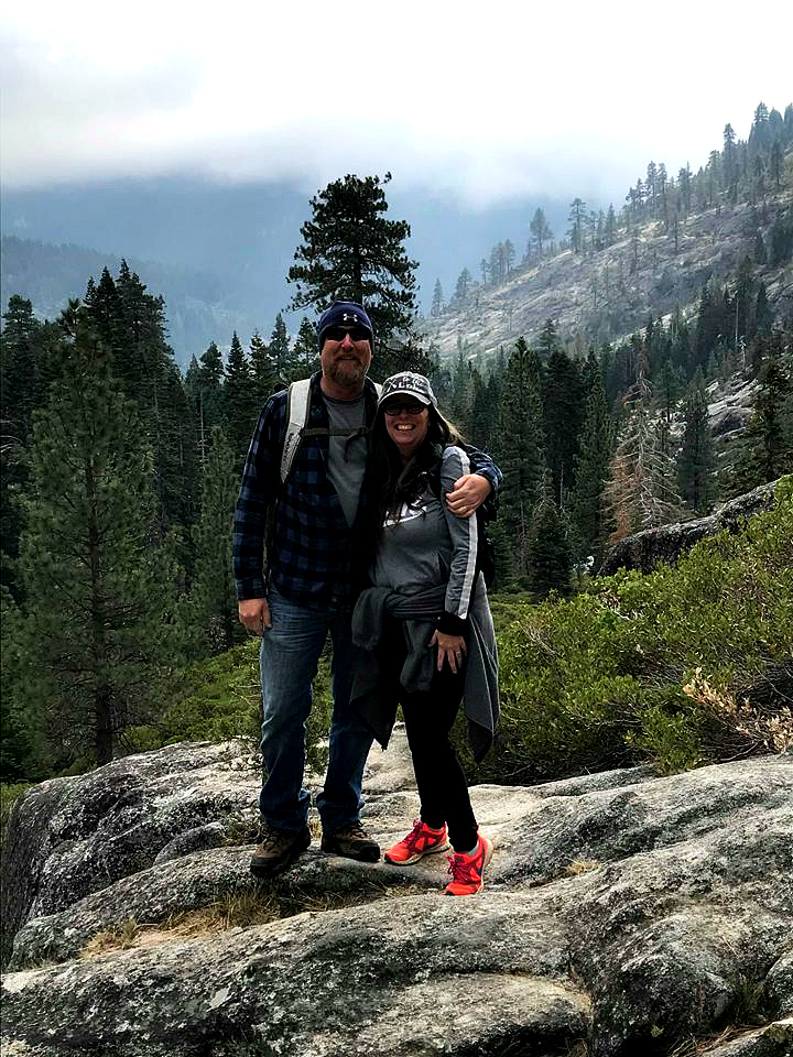
Continuing on the trail, it will start to climb in elevation and become harder to stay on the trail. Notice the photo below where my husband and daughter are standing on huge granite slabs. There is no clearly marked trail in this section, so keep and eye out for cairns’ (rock pile stacks made by fellow hikers) as they will help guide you. Sometimes even with the help of the cairns, you can still get off the trail, so make sure you are always aware of your surroundings and directions you shoud be hiking in :). This is a pretty popular trail so usually you can spot other hikers and get back on course. Notice the shorts being worn by my husband, this picture was taken in the beginning of summer when it is much warmer 🙂

Not much further and you will come to the desolation wilderness area. This area requires a permit to enter. After Memorial Day weekend, and before the end of summer, permits are available in the box provided on this trail at the edge of the wilderness. Any other times, you must obtain a permit at one of the local ranger stations. The permits are free.
Grab your permit from the box and fill it out (make sure you have a pen or pencil) leave one section in the box and the other attached to your back pack. These permits are for your safety as the Forest Service likes to know who is entering the area in case of emergencies. You can see by the map below provided by the US Forest Service that the green line shows you where the desolation wilderness starts. You can also see the huge area of beautiful trails and lakes to discover past horsetail falls :). They are on my list to explore!

As you enter desolation wilderness, the trail starts to get a little more challenging. Not only are you climbing in elevation pretty quickly, but the boulders start to get bigger. There are some that you literally have to climb up and over. There may also be smaller creeks to cross as well, It just depends on if you stay on the main trail or get off onto another one lol. Which happens a lot on this trail!! You will go up one way and come down another becuase the trail is not easily marked like I said earlier.

This is where those good hiking shoes start to pay off! The boulders that you will encounter on the path can easily twist an ankle. I know, as I have lost a good foot hold a few times on this part. And as I said earlier the boulder get even bigger from here on.
The first time I took this trail I did get a little winded, because I wasn’t used to hiking. Now that I hike a lot more this trail was a lot easier. Its still a workout but I definitely did a lot better on the second time :). So if you hike fairly regularly you should do great.

The trail can change due to the snow melt and run off coming down or storms producing lots of rain. It can cover some of the original trails and you will need to hike around those areas.
There have been times I have had to cross logs in water to get to another trail and continue up. Like in this picture below LOL! My sister in law was cracking up wondering where the heck I was taking her lol!

As you get closer to the waterfall there is again more areas to step off the trail and enjoy the water 🙂 This picture is during the summer months and the weather was so warm. The water was still chilly but I love to just put my feet in it and sit by the waters edge and relax. Just look at that crystal clear water!! It’s gorgeous.

As you make it to the base of the waterfall, be very careful! Rocks can be slippery. Also there are some sheer drop off areas. If you have little kids, you will really need to watch them in this area! I usually stop here to eat my lunch and kick back and listen to the sounds of the water crashing down from the beautiful waterfall! Its so nice to be out in the middle of the wilderness listening to the all of natures beautiful sounds! When I am having a stressful week, all it takes is a hike like this or a kayaking trip to calm my mind.

To give you an idea on how big this water fall is, take a look at those little trees off to the right. Those are pine trees 🙂 The water fall spills down in a few different stages from the lake above. So its actually like one long sloping water fall of over 500 feet. It’s absolutely breathtaking in the spring when the snow run offs melts.
You can continue on the trail past this which takes you up the side of the waterfall, however I haven’t tried this yet. I hear it is pretty challenging and very slippery. If you decide to go up to the top, I would suggest you read other hikers reviews before you go so that you know what to expect.
The view back towards highway 50, not far from the water fall, is absolutely beautiful! We happened to have a storm coming in on us while we were at the top. It was very pretty! Although, we did need to hike a little faster back down as it started to sprinkle.

I definitely recommend this hike if you’re up to it. It is absolutely gorgeous and a great work out :). Allow your self plenty of time to just enjoy all the beauty around you and also dip your feet in the water lol!
If you need to obtain a desolation wilderness permit in the off season months the closest ranger station to this hike is listed below.
- Ranger station in Camino – Open monday through friday 8-4:30pm Located at 4260 8 Mile road in Camino.
Please be sure to always pack out what you packed in! We want to keep our forests looking beautiful :).
List of items I bring on this hike
- good hiking shoes (my tennis didn’t do so well lol)
- hydroflask or water bottles
- high energy snacks
- good hearty lunch
- light jacket (even in the summer you can get caught in a thunder storm)
- camera
- $5 for parking
- pen or pencil for filling out forms
- sunscreen
- hat
- mosquito repellent (although when I have gone it hasn’t been too bad)
Have you hike this trail before? Have you been to the very top of the waterfall?
Chat Soon!
Trudy
About The Author
Trudy
Related Posts

The Most Challenging 1.5 Mile Hike I Have Done So Far.
Bryce Canyon National Park in Utah, USA has some of the most unique landscapes I…
June 5, 2018
What to do for beginners in Zion National Park
If you haven’t been to Zion National Park before then put it on…
June 5, 2018
Toya | 6th Jun 18
Wow the changes of the trail, the beautiful water falls. This looks awesome. Horsetail falls is a beautiful place.
Trudy | 6th Jun 18
Yes the trail does have many changes. 🙂 Glad you liked it!
Patti | 6th Jun 18
This is a very informative article, than you. It looks like a great hike.
Trudy | 6th Jun 18
Thank you so much!
Debra | 7th Jun 18
Loved your article. I felt like I was walking with you. Can’t wait to try this trail. Thank you for all of the information.